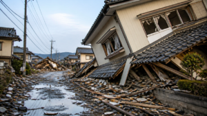
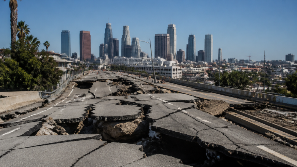
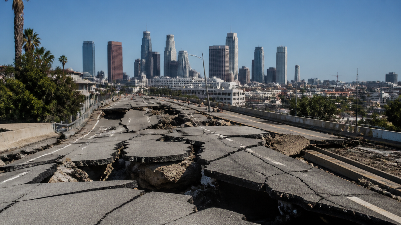
When an earthquake strikes Los Angeles, the ground moves beneath millions of people, and questions flood social media within seconds: How strong was it? Where did it hit? Will there be aftershocks? Living in or visiting Los Angeles means understanding the seismic forces constantly reshaping the region. Southern California experiences thousands of tremors annually, most too faint to notice, yet the potential for a major earthquake remains a defining reality of life here. This guide explains what’s happening geologically, how real-time monitoring works, and what steps residents and visitors should take to stay safe. Knowledge and preparation aren’t just sensible—they’re essential.
Quick Questions and Answers
Question: Why did people feel an earthquake in Los Angeles today? A magnitude 4.6 earthquake struck the Los Angeles area near Highland Park, causing strong shaking felt across the region. Residents reported rattling dishes and glasses, and a medical building shook. The quake occurred about 7.5 miles below the surface and was widely felt due to its shallow depth and proximity to populated areas.
Question: Can a small earthquake in Los Angeles cause damage? Small earthquakes like recent 2.9 magnitude events near Highland Park typically cause no injuries or major damage. However, larger quakes above magnitude 6 can occur infrequently, roughly every 40 to 45 years. While minor tremors may rattle items, significant damage usually requires stronger ground shaking.
Question: Are earthquakes common in the Los Angeles area? Los Angeles has a high level of seismic activity with about 2,200 quakes per year on average based on 54 years of data. The area experiences multiple small earthquakes daily, with 7 recorded in the past 24 hours and 72 in the past week. Most are too small to be felt by residents.
Core Concepts of Southern California Seismic Activity
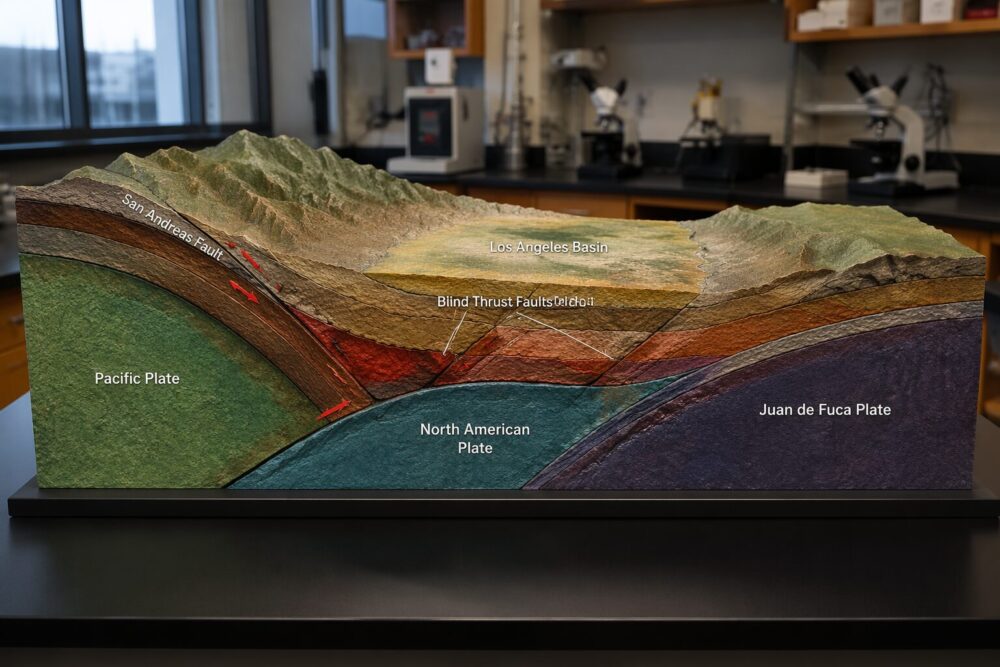
The San Andreas Fault runs roughly northwest to southeast through California, marking the boundary where the Pacific Plate grinds against the North American Plate. This tectonic interaction releases enormous stress, and Los Angeles sits directly in the zone where that tension accumulates. The fault doesn’t run directly under the city center—it’s about 30 miles to the northeast—but the stress radiates outward through the entire region.
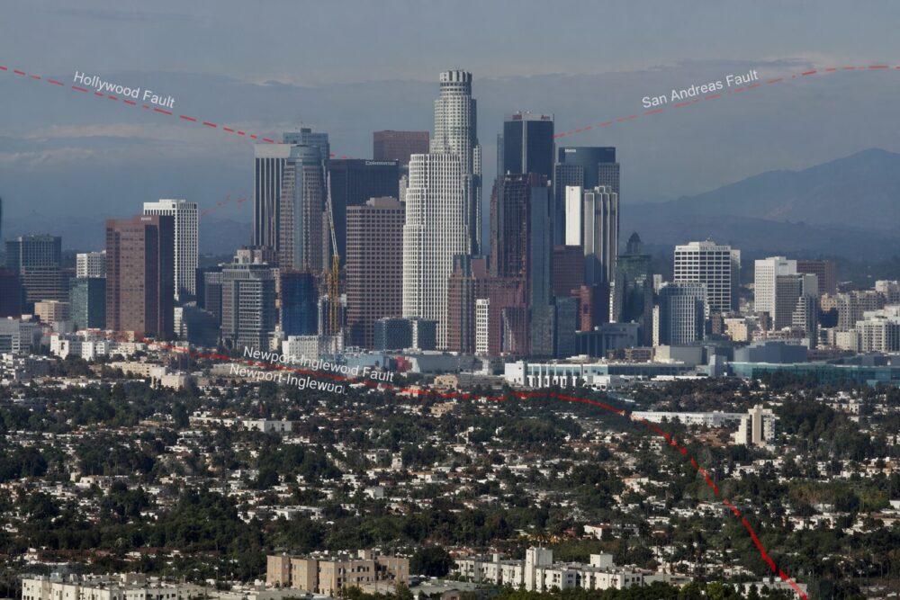
What makes LA’s seismic situation even more complex is the presence of blind thrust faults. These are fractures buried deep underground that don’t rupture through to the surface, making them harder to map and predict. The 1994 Northridge earthquake occurred on a blind thrust fault, catching scientists and residents off guard. Downtown Los Angeles sits above several of these hidden features, a fact that influences building codes and retrofit requirements citywide.
Magnitude measurement is how seismologists quantify earthquake energy. The official standard is the Moment Magnitude Scale, managed by the USGS, which replaced the older Richter Scale for scientific accuracy. Each whole number increase in magnitude represents roughly 32 times more energy release. The difference between a magnitude 4 and a magnitude 5 is enormous—not just twice as strong, but exponentially more powerful. This matters because even small shifts in magnitude can mean the difference between something people barely notice and something that causes real damage.
Monitoring Real-Time Seismic Data
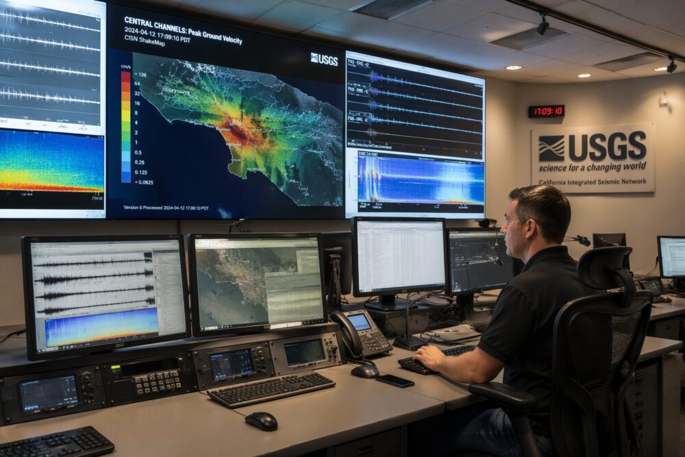
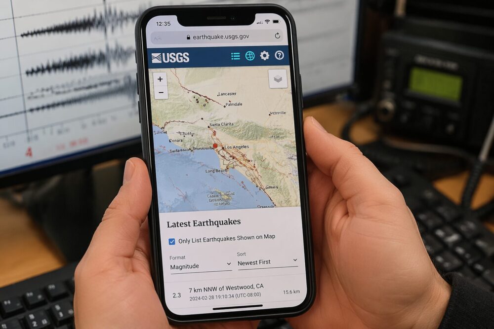
Seconds after an earthquake occurs, data streams into monitoring centers across Southern California. The USGS maintains an interactive “Latest Earthquakes” map where you can filter events by time, magnitude, depth, and location. For Los Angeles specifically, you can set the search radius to show only tremors near the city and see what’s happened in the past hour, day, or week. This transparency lets residents understand local seismic patterns rather than relying on news reports alone.
The California Integrated Seismic Network (CISN) integrates readings from hundreds of seismometers—sensitive instruments buried in the ground and mounted on buildings—to create a real-time picture of ground motion. These sensors detect vibrations humans can’t feel, measuring acceleration, velocity, and displacement across three dimensions. When an earthquake strikes, this network triangulates the epicenter location, calculates depth, and estimates magnitude within minutes, sometimes seconds.
The ShakeAlert system, also managed by the USGS, represents a major advance in earthquake response. When a large earthquake ruptures, seismic waves travel outward at different speeds. The fastest waves reach monitoring stations near the epicenter first, allowing the system to calculate the quake’s size and send alerts to areas still 10 to 60 seconds away from the strongest shaking. Compatible smartphones in Los Angeles receive push notifications providing precious seconds to drop, cover, and hold on before the most damaging waves arrive. This isn’t prediction—it’s rapid detection and warning after a rupture has already begun. The system has proven effective in practice, and uptake continues to grow.
Modern Mitigation and Infrastructure Standards
Los Angeles learned expensive lessons from past earthquakes, particularly Northridge in 1994. That quake caused an estimated $20 billion in damage and exposed vulnerabilities in the building stock. In response, the city enacted increasingly strict seismic standards.
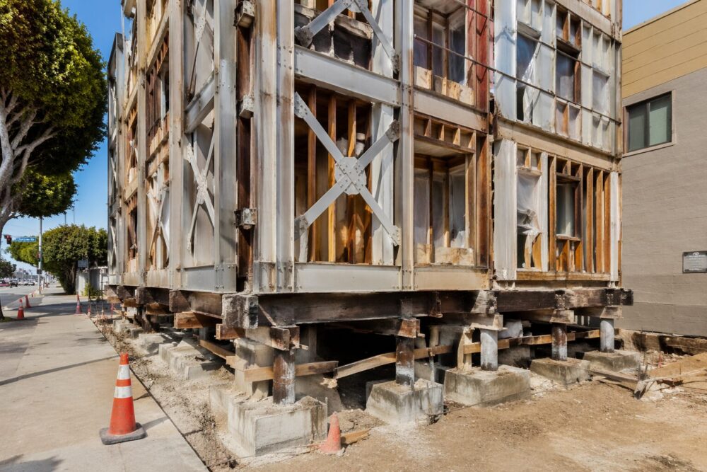
The Mandatory Soft-Story Retrofit Program (Ordinance No. 183893) targets older residential buildings with tuck-under parking—essentially buildings where the ground floor is mostly open for cars, removing natural structural bracing. These buildings are prone to collapse in strong earthquakes. The ordinance requires owners to strengthen these structures with steel bracing or other reinforcement. Compliance deadlines have extended over many years, but the retrofit wave has visibly transformed blocks across LA as scaffolding and construction crews work on thousands of buildings.
Non-ductile reinforced concrete buildings present another challenge. Built before modern seismic codes (roughly pre-1975), these structures can fail suddenly during strong shaking because the concrete and rebar lack the flexibility to absorb energy. Los Angeles has implemented strict assessment and bracing requirements for these buildings, with some facing demolition if retrofit costs exceed practical limits.
On the residential side, the California Governor’s Office of Emergency Services publishes safety checklists focusing on simple but effective measures: securing water heaters to wall studs (a common cause of gas leaks and fires post-earthquake), anchoring tall furniture like bookcases to prevent tipping, and storing heavy items on lower shelves. These actions reduce injuries and fire risk in the critical hours after a major quake.
| Safety Measure | Cost Range | Effectiveness | Who Should Prioritize |
|---|---|---|---|
| Secure water heater | $100–$500 | High—prevents gas leaks and fires | All homeowners |
| Bolt foundation | $3,000–$7,000 | Very high—prevents house from sliding off foundation | Older homes on concrete slabs |
| Soft-story retrofit | $30,000–$100,000+ | Very high—prevents building collapse | Multi-story buildings with open ground floors |
| Anchor furniture | $50–$300 per item | Moderate—prevents injuries from falling objects | All households, especially those with children |
| Install ShakeAlert | Free | Moderate—provides seconds of warning | All smartphone users in LA County |
Historical Context and Major Example Events
The 1994 Northridge earthquake (magnitude 6.7) struck at 4:30 a.m. on January 17, shaking awake millions of sleeping residents. The epicenter was about 15 miles northwest of downtown, directly beneath a residential neighborhood. Peak ground acceleration in some areas reached 1.8g—meaning the ground accelerated upward at nearly twice the force of gravity. Freeways collapsed. Apartment buildings pancaked. Hospitals sustained damage despite being designed to higher standards. The disaster killed 57 people and injured nearly 9,000, with economic losses exceeding $20 billion.
The 1933 Long Beach earthquake (magnitude 6.4) preceded modern building codes and killed 120 people, most in unreinforced masonry buildings. That event prompted California to enact its first meaningful seismic building standards, establishing the principle that structures must be designed to survive earthquake motion. Without Long Beach, LA’s construction landscape would look drastically different today.
Contemporary research, particularly through the Southern California Earthquake Center (SCEC), focuses on the potential for a much larger rupture—sometimes called the “Big One.” A magnitude 7.8 event on the southern San Andreas Fault could produce shaking far more intense than Northridge, with cascading infrastructure failures affecting water systems, power grids, and transportation. Scientists don’t predict when this will happen, only that it will eventually occur, making preparation all the more critical. Recent studies have also revealed that some fault segments may rupture more frequently than previously thought, a sobering reminder that earthquake risk is not uniformly distributed across time.
Latest Updates and How to Find Official Information
Real-time earthquake information flows through multiple official channels. The USGS Earthquake Hazards Program provides continuous updates, scientific analysis, and public education resources. You can follow USGS social media accounts for verified earthquake information—critical when misinformation spreads quickly after a temblor. The MyShake mobile application, also developed by USGS, combines personal seismic detection with the ShakeAlert warning system, turning your phone into both a sensor and an alert device.
The annual Great ShakeOut drill, held each October, provides a coordinated opportunity for residents, businesses, and institutions to practice earthquake response. Millions of participants across Southern California simultaneously perform the “Drop, Cover, and Hold On” sequence at 10:15 a.m., reinforcing muscle memory for the critical seconds when shaking begins. Schools, offices, and emergency services use the drill to test communication systems and refine response plans. Participating in the Great ShakeOut is free and takes just a few minutes—a small investment with real value.
For Los Angeles County residents seeking official alerts, the NotifyLA portal allows you to sign up for emergency notifications about earthquakes, flooding, and other hazards. You can choose to receive alerts via text, email, or phone call, customized to your specific location within the county. During and immediately after a major earthquake, these notifications might include information about damage assessments, shelter locations, or water distribution points.
My Experience With Earthquake Now Los Angeles
I’ve felt several earthquakes while living in Los Angeles—the small ones that rattle your coffee cup and make you pause mid-conversation, and one stronger event that shook the walls noticeably. The small tremors are honestly kind of surreal; there’s this moment of “Is that happening right now?” before your brain processes it. The stronger quake was genuinely unsettling, the kind of experience that makes you realize you actually do need that emergency kit you’ve been meaning to assemble.
What struck me most while researching this was how much of earthquake safety comes down to simple, preventative action rather than heroic response. Bolting a water heater costs a few hundred dollars but prevents fires that could spread for blocks. Soft-story retrofits are expensive, but they literally prevent buildings from collapsing. ShakeAlert gives you maybe 20 seconds of warning in Los Angeles, which sounds short until you realize it’s enough to drop and take cover before the worst shaking hits. The gap between doing nothing and doing something is enormous, but the steps themselves are manageable and concrete.
I also learned that Los Angeles’s building stock has genuinely improved over the past 30 years due to regulation and retrofit mandates. It’s not glamorous work—it’s scaffolding and steel bracing and code compliance—but it’s reduced the likely casualties from a future major earthquake. That’s engineering and policy working as intended. Have you or anyone you know experienced earthquake damage, or taken specific steps to prepare your own home?
FAQ
Q: How deep is the earthquake that hit Los Angeles?
The recent 4.6 magnitude earthquake centered near Highland Park occurred approximately 7.5 miles (12.1 kilometers) below the surface. This shallow depth contributed to the strong shaking felt across the neighborhood and surrounding areas. Shallow earthquakes tend to cause more intense ground motion at the surface compared to deeper events of similar magnitude, which is why depth matters as much as magnitude when assessing impact.
Q: Will there be a tsunami after the Los Angeles earthquake?
The National Weather Service confirmed that no tsunami is expected following the recent 4.6 magnitude earthquake in Los Angeles. The quake was centered inland near Highland Park rather than along the coast. Tsunamis require underwater earthquakes or underwater landslides to generate the large wave displacements needed, so inland events pose no tsunami risk regardless of magnitude.
Q: What was the largest earthquake in Los Angeles this year?
The largest earthquake in the Los Angeles region this year was a magnitude 4.3 event near Muscoy, California. Other notable recent quakes include a 4.1 magnitude event in Frazier Park and a 2.9 magnitude quake near Highland Park that was felt widely across the city. Magnitude varies year to year depending on fault stress release patterns in the region.
Q: Do earthquakes in Los Angeles happen at night or day?
Earthquakes in Los Angeles occur anytime, with no specific pattern tied to time of day or night. Seismic activity is governed by tectonic stress release, not circadian cycles or human activity. Recent data shows quakes happening in early morning hours (like a 2.9 magnitude event at 5:07 am) and throughout other times of the day and night. Residents should maintain earthquake preparedness 24/7.
Q: How far away was the recent earthquake from downtown Los Angeles?
The recent 4.6 magnitude earthquake centered near Highland Park, a neighborhood approximately 6 to 8 miles northeast of downtown Los Angeles. This relatively close proximity allowed shaking to be felt strongly across the entire Los Angeles area, including downtown, the Westside, and surrounding communities. Distance from the epicenter is a major factor in shaking intensity experienced at any location.
Q: Which agency monitors earthquakes in Los Angeles now?
The U.S. Geological Survey (USGS) monitors and reports earthquakes in Los Angeles through its national network of seismometers and rapid reporting systems. The Southern California Earthquake Data Center (SCEDC), operated jointly by Caltech and USGS, archives and distributes seismic data for research. Local city resources and emergency management agencies also track seismic activity, but USGS remains the primary authoritative source for official earthquake information and magnitude determination.
Q: When was the last major earthquake near Los Angeles?
The strongest recent major earthquake in the greater Southern California region occurred on July 5, 2019, with a magnitude of 7.1, striking 124 miles north-northeast of Los Angeles near Ridgecrest. That event was powerful enough to be felt in LA but did not cause widespread damage in the city. Since 1900, Los Angeles has experienced at least three earthquakes above magnitude 6, with major events tending to occur roughly every 40 to 45 years on average.
Key Takeaways
Maintaining a 72-hour emergency supply kit is the baseline recommendation for all Southern California households. This means water (one gallon per person per day), non-perishable food, first aid supplies, flashlights, batteries, a battery-powered or hand-crank radio, and medications. Keep kits in your home, workplace, and vehicle so you’re prepared wherever you are when a quake strikes.
Developing a family communication plan is essential, particularly for scenarios where cellular networks may be overloaded immediately after a major earthquake. Identify an out-of-state contact person everyone will try to reach, establish meeting points if separated, and discuss what to do if you’re at work or school when it happens. Written plans are better than assumptions because stress impairs memory.
Prioritizing structural safety through professional inspection of gas lines and foundations is the single highest-impact action an owner can take. A gas leak after an earthquake kills more people than the quake itself through fires. Foundation bolting prevents a house from sliding sideways off its foundation—a common failure mode. These investments pay dividends if a major earthquake ever strikes.
Conclusion
Earthquakes in Los Angeles are not a question of “if” but “when.” The geological forces that drive seismic activity show no signs of slowing, and the region’s rapid fault movements ensure continued earthquakes for millennia to come. What’s changed over the past 30 years is preparedness. Better building codes, retrofit mandates, warning systems, and public education have genuinely reduced the likely casualties from future earthquakes.
Living with earthquake risk in Los Angeles doesn’t mean living in fear—it means taking straightforward steps to protect yourself and your household. Secure your home, know how to respond when shaking starts, keep emergency supplies accessible, and stay informed about official resources like ShakeAlert and the USGS earthquake maps. These actions compound, creating real resilience.
The next earthquake that hits Los Angeles will teach new lessons, as each one does. Until then, knowledge and preparation are your best tools.
References
- U.S. Geological Survey. (2024). Latest Earthquakes. Earthquake Hazards Program. https://earthquake.usgs.gov/earthquakes/
- California Governor’s Office of Emergency Services. (2024). Earthquake Safety Tips for the Home. Cal OES. https://www.caloes.ca.gov/
- U.S. Geological Survey. (2024). ShakeAlert – Earthquake Early Warning System. Earthquake Hazards Program. https://earthquake.usgs.gov/earthquakes/events/
- Southern California Earthquake Center. (2023). SCEC Research Overview. University of Southern California. https://www.scec.org/
- City of Los Angeles Department of Building and Safety. (2024). Mandatory Soft-Story Retrofit Program (Ordinance 183893). https://ladbs.lacity.gov/
- Caltech Seismic Laboratory. (2024). Southern California Earthquake Data Center. https://scedc.caltech.edu/
- National Weather Service. (2024). Tsunami Hazards Program. https://www.weather.gov/tsunamis/
- United States Geological Survey. (2023). Earthquake Probability Mapping. Hazards Program. https://earthquake.usgs.gov/earthquakes/probability-mapping/

Sarah Anderson . J
I’m the mom behind Wise Mom Blogger, where everyday creativity meets real-life motherhood. I share easy DIY crafts, cozy knitting and crochet projects, beginner-friendly sewing ideas, and family-tested recipes—plus quick baking hacks that make homemade feel doable on busy days.